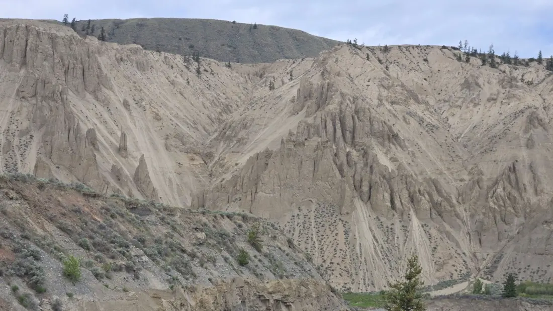
Sand dunes in Canada sound like a trick — but at Farwell Canyon, about 100 km west of Williams Lake in the Cariboo-Chilcotin region of British Columbia, they're real. The canyon near Riske Creek holds some of the country's only natural sand dunes, and the dune trail here leads to the biggest in the province.
The draw isn't just the sand. The Chilcotin River cuts through the canyon in a striking aqua-grey, flanked by layered limestone and sandstone walls carved into hoodoos — those tall, thin sandstone columns that look like something out of the American Southwest. Bighorn sheep graze the slopes, and the dry, almost desert-like conditions have preserved ancient pictographs left on the cliffside by early First Nations, some potentially thousands of years old.
The main outing is a 3.2 km loop that AllTrails describes as short but rewarding, with hoodoos in every direction. It's rated moderately challenging and doubles as a solid birding spot; the sweet spot to go is June through September. If you'd rather stay near the water, a riverside path lined with cacti passes a pair of decaying pioneer cabins that add a genuine Old West atmosphere to the whole scene.
Getting there takes commitment. From Vancouver it's roughly a seven-and-a-half to eight-hour drive up the Trans-Canada Highway and Cariboo Highway 97 N to Riske Creek, then along Farwell Canyon Road to the canyon itself. The road stays open most of the year, but it's unpaved, with steep sections and washboard surface in spots — a vehicle with decent clearance and a bit of patience are wise.
One thing to know before you go: parts of the area are designated caretaker land by the Tl'esqox First Nation, so any closures or signage should be respected. It's a working landscape with deep cultural history, and treating it that way is part of the deal.
For travellers, the appeal is obvious: this is a strange, beautiful pocket of B.C. that almost nobody outside the region has heard of, combining dunes, hoodoos, pictographs and river views in one easy-to-reach (once you're there) stop. It works well as a break on a road trip through the Chilcotin, or as a detour for anyone heading toward the Bella Coola Valley. Pack water and sun protection — the dry conditions that preserved those pictographs apply to visitors too.
Story via Curiocity.