On paper, the Continental Divide Trail runs 3,038 miles from Mexico to Canada. In practice, nearly everyone who hikes it customises the route, and nowhere is that more true than in southern New Mexico. Soon after leaving Silver City, northbound hikers face a fork: slog along the official trail through the dry, exposed Black Range, or drop into the Gila Alternate — and the overwhelming majority choose the river.
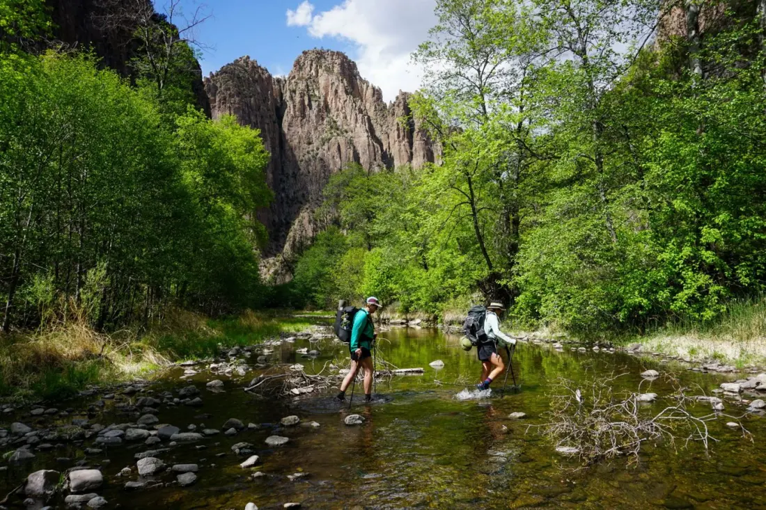
The trade-off sounds lopsided on a map. The alternate skips roughly 178 miles of the official route and cuts 74 miles off the total hike, following about 104 miles of the Middle Fork of the Gila River through a canyon system. But what you give up in mileage you gain in experience. After weeks of long water carries in the desert, hikers reach a canyon where clean, flowing water is always within reach. Ponderosas, cottonwoods and sycamores replace burned ridgelines, and shade from the canyon walls offers the first real relief from the sun since the border.
There's history here too. The Gila Wilderness was designated the world's first wilderness area in 1924, and a short side trip leads to the Mogollon cliff dwellings, inhabited roughly 700 years ago. Hikers can also detour to Jordan Hot Springs and resupply at Doc Campbell's Post general store. Many camp on sandy riversbars, cowboy-style, falling asleep to moving water under a full spread of stars.
It's not all idyllic. The route involves more than 150 river crossings, ranging from ankle-deep wading to chest-high current that has forced hikers to swim. Depth varies wildly year to year with snowmelt and rain, so check the USGS Gila River Gauge beforehand: under 100 CFS is easy wading, 150-250 CFS means fast knee-to-thigh water, and above 300-400 CFS the high route is the smarter call. Expect a slower pace too — the writer averaged about 15 miles a day on sand versus 25 in the desert — plus slippery riverbed rocks, cool canyon mornings, and a genuine chafing risk from days of wet feet and gritty shorts. Trail runners beat waterproof boots here, since they dry out quickly, and a small tub of body lotion turns out to be the most valuable item in the pack.
New connector trails (Trail #28 and Trail #730) have changed the game recently: hikers can now mix canyon floor and rim walking instead of committing to one or the other, with bailouts like the Big Bear Trail letting you climb out early if crossings look dicey. The route rejoins the official trail just south of Pie Town, where New Mexico's long, dry stretches resume — which is exactly why veteran hikers say to enjoy the wet miles while you can.
For anyone eyeing a Continental Divide thru-hike, this is essential planning material. For everyone else, it's a window into a wild corner of New Mexico where you can walk a river canyon past hot springs and ancient dwellings — one of the most characterful hiking experiences in the American Southwest.